Update 12/02/2009: This is the last post about our 5-week flight across the U.S., and to read it in sequence you can click here.
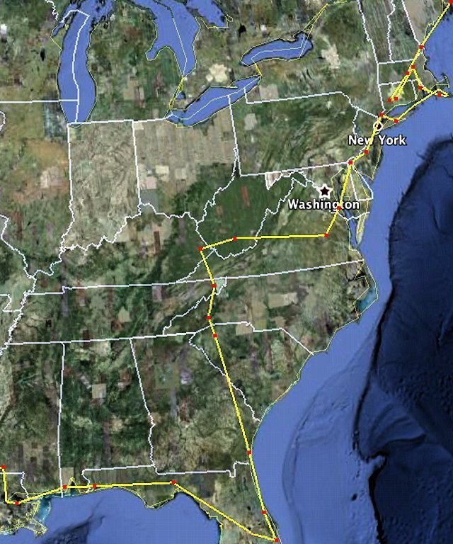
This is an approximation of the other third of our path on this Big Adventure, the part from Maine down to Florida and to Mississippi where the actual GPS track starts. You’ll notice we backtracked a bit in the Northeast by going to CT for a few days (and two different airports in Waterbury), then back up to MA, down to RI, across to Martha’s Vineyard (MA again), out to Nantucket and back, up to Hyannis and then down to Long Island. For simplicity our three jaunts along the Hudson (down and back one evening, then back down the next day on our way to DE) are shown with just one line.
If you’re interested in the larger-size versions of these three maps, download them because I’ll be deleting them from the Photo page in a few days (these smaller versions will still be here on the blog, but you can’t really see much at this size). If you don’t know how to download them, I put directions in the description for this most recent one on the Photo Page (click the thumbnail photo to see the medium size with the directions, then click the “All Sizes” icon at the top margin of the medium pic to see the full size one and download it per the directions that you read on the medium size one – Won’t it be nice when computers can talk like on Star Trek?)


