John & Anne Wiley

2009/11/06

Last Leg

Filed under: Aviation,Big Adventure,Flying,Has Photos — John @ 07:05
We woke at 6am in Blythe, wondering why we felt so rested so much earlier than any other morning on our trip. It was pretty surprising then that we didn’t actually take off until 1:30pm! We could probably recreate all we did during those seven hours plus, but it would take a lot of effort. Just a bunch of little stuff and an easy feeling based on no set schedule, no impending weather, and plenty of time for the short hop home.
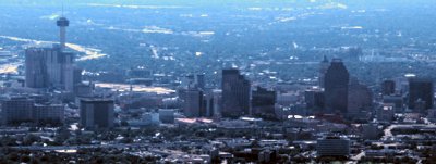
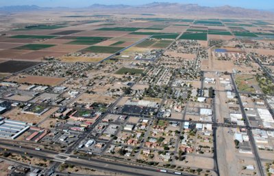
Here’s how it looked as we turned briefly back toward the East to fly over the town for a different look at where we’d just been.

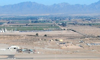
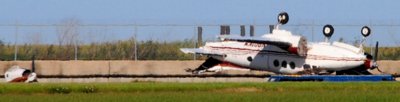
Flash was parked minutes before this, in front of that large white arched hangar with a door open and another plane parked out front. You can see the end of a runway, but not the perpendicular one we just took off from. Down the frontage road angling to the left up the pic you can just make out the town beneath the distant hills. The river doesn’t show, but it’s fairly far beyond the city and surprisingly the verdant banks near the freeway are given over mostly to RV camping.

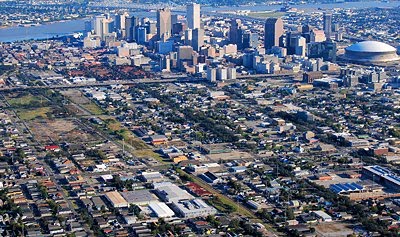
Here’s a shot looking North at the town center where we shared an especially good chicken tostada last night at Rosita’s for less than $4.
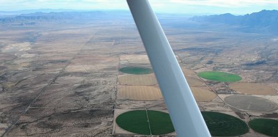
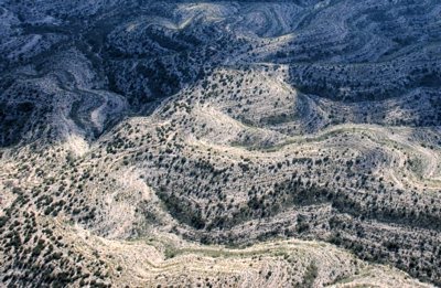
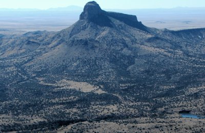
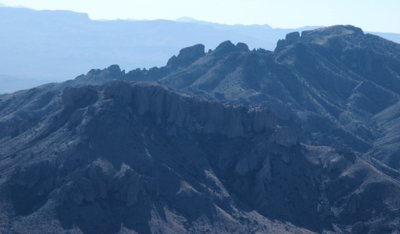
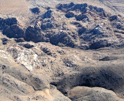
Heading toward home, we saw lots of interesting desert features pass below. Some of the pix came out ok in the relatively clear air, but not long after Palm Springs things changed. I’ve sent a few other pix to EdHat.com (see Local News or the “More Words” link here), and posted a few larger ones on my Photo page (see the “More Photos” link here).
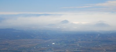
Over LA the smog was so thick we thought for quite a while there was a wildfire burning. It had a defined edge that you can see at the left of this pic. My guess is the wind was moving it to the left and then winds just a bit higher just below the 6,500 feet we were at blew it back toward the right creating the edge effect you can see.
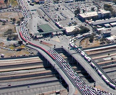
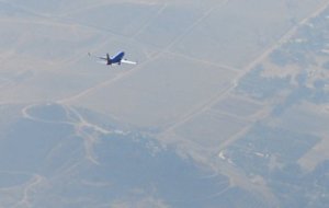
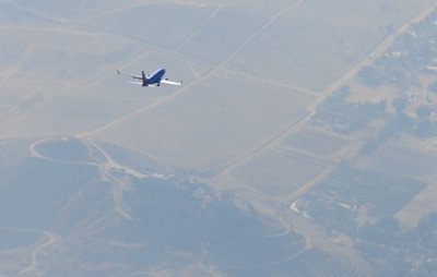
By the time we neared Ontario’s busy airport, jets descending below us virtually disappeared as their passengers were getting those tray tables latched and preparing to breathe visible air.
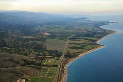
We flew over Lake Cachuma and feasted our weary eyes on our favorite places across the mountains to the sea. After stopping in Santa Ynez to fuel up Flash for her next adventure with another Club pilot tomorrow, we delighted at the sights of scenic Santa Barbara all over again.
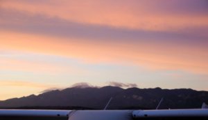
The welcoming sunset was delicate, with wisps of cloud on the peaks, air brush colors above, and the SBA control tower blinking just above trusty Flash’s protective wings. She seemed at once happy to have flown us so far and safely, to catch a night’s rest on her home spot, and to anticipate feeling the touch of a different Club pilot for the next few days until her routine annual inspection Monday. That’s when she’ll get some extra pampering, and we might go out to pat her nose appreciatively one more time. We added 75 hours to her tachometer reading on this trip, flying many more hours than that by going slowly rather than full power.
Tomorrow we’ll start making a list of every airport we stopped at, and trying to write up some of the experiences we didn’t blog for our own savoring. If anyone’s still reading this, you’ll probably be treated to a few more words and pix from the trip. We’ll also probably respond to some of your previous Comments, and Anne says she might add Comments of her own as a way to share some of her memories without learning to do a full blog. For now, sweet dreams…

No Place Like

Filed under: Big Adventure,Has Photos — John @ 02:55


HOME!!

We stopped in Santa Ynez for fuel, so this was taken as we approached SBA from the West. You can see the edge of the nasty LA smog we flew over coming in from Blythe. I’ll blog the day in an hour or two, but wanted to tell anyone who’s wondering that we’re home safe, happy, tired, and overflowing with happiness and sweet memories!

2009/11/05

California Dreaming

Filed under: Aviation,Big Adventure,Flying,Has Photos — John @ 06:05
Flash kept some fast company today, starting with this Navy jet that rolled past as we prepared for takeoff from El Paso.

We enjoyed being routed over the city before turning West, because it gave us a glimpse of the downtown we’d wandered yesterday on foot. It also provided a safe and fast view of the border crossings where cars, trucks, trains, buses, cycles and pedestrians funnel down for what can be a multi-hour test of patience.
We had intended to fly low to enjoy the desert scenery, but after a few thousand miles droning over scattered shrubs (about ten minutes of clock time) we climbed higher. Flying a mile up helped us enjoy the scenery more and also speeded our crossing of the desert. As on nearly every flight of this Big Adventure, yet again we had tailwinds! Crossing from NM into AZ we saw one of the few clearly delineated state lines of this trip, looking toward Mexico. The AZ side has big round irrigated fields while NM looks more natural.

In the mountains about 20 miles toward Tucson from the state line is a vast area of stone pillars we hadn’t seen marked on the charts or noticed on the maps Anne brought. We took many pix, and this snap of two stone armies facing off across a ravine is a small slice.
Now that we’re home, we’ve learned that it’s the Chiricahua National Monument.
Rather than spend the night in Tucson we decided to land for fuel just past there and press on to make for a shorter flight home tomorrow. The airport we chose happens to be the final resting place for acres of jets. While some were being torn apart, others were prepared for storage until the economy recovers and some were getting routine maintenance. Very surreal place, especially for a pilot. Flash seemed a bit sad to taxi freely among her faster parked cousins, and eagerly leapt back into the air when we discovered the airport no longer sells fuel.
It felt good to land in California, and we’re enjoying the least expensive hotel of the many on our trip. We had permission to set up the tent right next to the plane at the Blythe airport, but decided that wouldn’t provide much sleep since there’s a construction crew doing night work on runways and the airport comes to life in earnest at sunup. So tonight we dream of home, unlimited sleep, our many adventures of the past month, and having easy access to more stuff than fits in two backpacks or a small plane. Will we ride around town on our new old tweaky tandem bike?

Blythely Returning

Filed under: Big Adventure — John @ 03:28

We’re in Blythe enjoying great (and so inexpensive!) Mexican food at Rosita’s. Next check in to a hotel (almost dug out the tent, but decided to maintain our unbroken record of not camping). Once settled I’ll explore today’s pix and follow up. Hope to reach SBA by late afternoon, and I can already see our emerald city appearing beyond the Santa Ynez range. Just wanted to post a quick note sharing our excitement about being back in CA!

2009/11/04

Backlog

Filed under: Aviation,Big Adventure,Flying,Has Photos,People — John @ 04:34
Dear Diary – I’ve been remiss in blogging recently, so here’s some backlog of words and pix. A few years, er… days ago we took off from New Orleans and got a better look at the Katrina aftermath. Right at the airport was sad evidence of this plane that apparently didn’t fly out in time. I wonder where it had been before this tragic end.

Nearly all of the city visible from the above has been either rebuilt or cleared away. Here and there are driveways that end in flat empty lots growing grass instead of families. I don’t know what the city looked like before, but to my eye the bare swath at the left was probably a thriving neighborhood.

We left late after sleeping in from Halloween, but the nearly full moon was high and bright in the clear air so we pressed on past Houston’s distant sprawling glow.
After a great night’s sleep at Staybridge pampered by the exceptional staff, morning saw us exploring Austin on our bike starting at the Capitol where a kind woman paused to snap us riding by (here you go, Nancy).
I hope this conveys some of what catches people’s attention, when they see us on one bike with two comfy seats and both pedaling. The only missing item from a standard tandem is that the trusting person in back holds onto my “handlebars.”
We loved the Bike & Hike trail along and across the Colorado. Didn’t know that river runs through Austin?

That evening (11/2) we arrived in San Antonio for another sweet time with family (we’re sure scattered across the country!). We strolled the River Walk, had dinner, and saw the Alamo where there were guards on duty and a steady stream of people pausing to read and contemplate the plaques.
Taking off this morning we got a distant glimpse of downtown, with the Space Needle on the left.
Didn’t know that’s in Texas? It turns out there are lots of familiar places in TX, including the Colorado River and the Space Needle. People here like theirs better than the “copies” you may have heard tell of in Colorado and Seattle.
Heading toward Dryden we noticed vast areas with “topographical” lines. I’m no geologist, but to me it looks like evidence this was once an enormous lake several hundred feet above where the Rio Grande now runs.

Having left San Antonio relatively early, and a bit surprised that we weren’t tired after our relatively short night’s sleep, we decided to divert south near the Mexican border toward Big Bend. I have zillions of pix with assorted geological features, so if you love such stuff let me know and we can enjoy a two month slide show together. For now, here are a few I like in this size and maybe I’ll post a few more on the Photo link. We turned back northwest again before reaching the park, so most of these pix are telephoto shots into the hazy distance.
Jagged edges, layered rows of ridges into the distance, and tall cliffs seem to fascinate me most. Any psychologists care to analyze that?

We arrived in El Paso in the afternoon, but by the time we chose a hotel and got the shuttle into town past a horrible looking accident on the freeway it was nearing sunset.

We walked around the downtown area looking for an authentic Mexican restaurant named Leo’s that was recommended by everyone we asked on the street. Like many people we saw along the way, the four in this photo shoot seemed sad somehow.
In the end we’d walked right past Leo’s because it was closed, so after exploring several blocks of loan and pawn shops next to bridal, beauty, curio, ammo and dollar shops we surrendered to an affordable though average meal in the hotel. We had talked about walking across into Juarez, but the first man who’d recommended Leo’s reacted with shock when we mentioned it. “You look like tourists, and that’s not good,” he said. He went on to inform us of several thousand murders there so far this year, and we decided to stay with our fond memories of walking the bridge for a fun afternoon twenty-some years ago.
Where will we fly tomorrow? Where will we land? Will we take an hour or two somewhere to ride our bike, take a cab, or otherwise explore someplace at ground level? Any suggestions?
« Previous PageNext Page »

Create a free website or blog at WordPress.com.